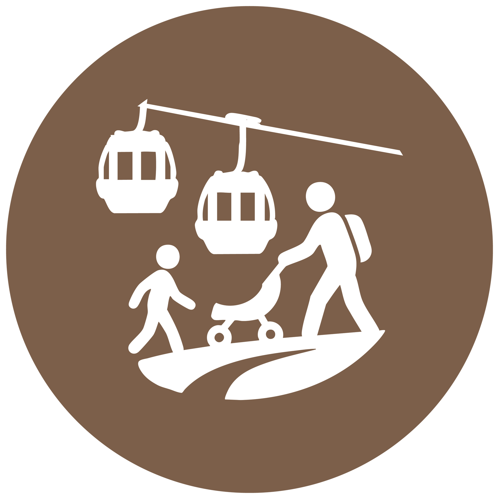
Recreation Opportunity Spectrum
A data-driven framework for understanding recreation experiences across the watershed


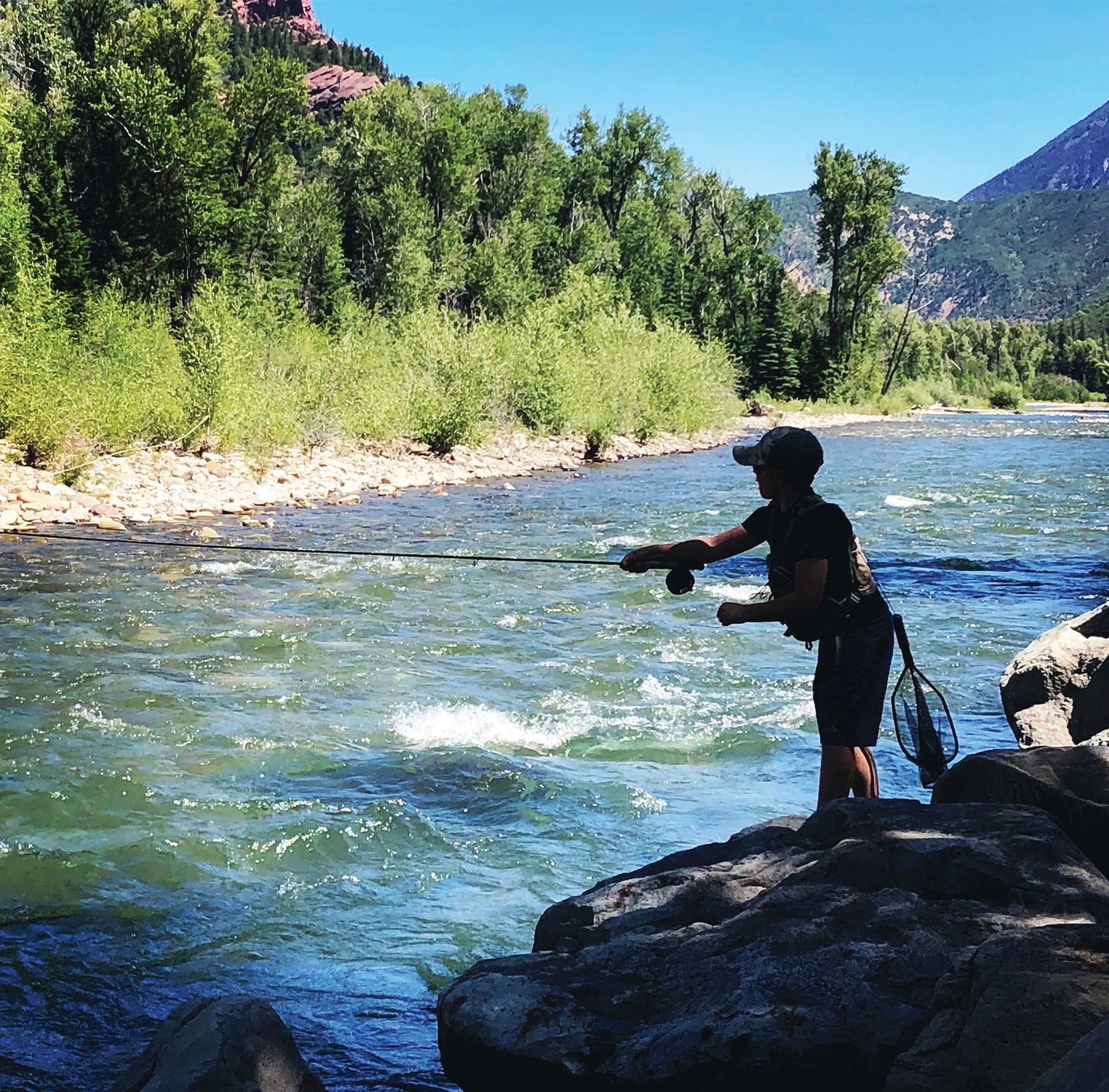
Outdoor recreation in the Roaring Fork Watershed spans a wide range of settings, from remote peaks and wilderness areas to well-used trails, recreation sites, and river access points near communities. Visitors come with diverse motivations that shape the kinds of experiences they seek.
To better understand and manage this diversity, Utah State University’s Recreation Ecology Lab conducted visitor surveys at 14 recreation areas and used a data-driven approach to classify 53 sites across the watershed into five distinct recreation groups based on social use, environmental conditions, and management presence. Analysis showed that visitors at more urban-proximate sites were motivated by spending time with family and friends and exercising, while those in more remote areas sought challenge, risk, and adventure. Across all sites, visitors consistently valued nature and tranquility, underscoring the importance of protecting natural resources. Together, the five recreation opportunity classes represent a spectrum from remote wilderness to developed hubs, providing land managers with a useful tool to align recreation opportunities and management strategies with both ecological conditions and visitor motivations.
This process builds on and updates the Recreation Opportunity Spectrum (ROS) framework, which describes how physical settings, social conditions, and management levels influence visitor experiences.
Resource Links:
- Economic Impact of Outdoor Recreation in the Roaring Fork Watershed
- Outdoor Recreation Planning Guidance: Explore key resources and data to support planning for exceptional and sustainable outdoor recreation.
Setting:
Remote, Undeveloped, and Quiet
These areas offer a true backcountry experience, far from roads, noise, and crowds. These areas are ideal for people seeking solitude, adventure, and a strong connection to wild nature. Visitors often travel by foot or horseback and rely on outdoor skills. Facilities are minimal to nonexistent. These places help preserve natural soundscapes, dark sky areas, wildlife
habitat, and quiet recreation.
Group Characteristics:
- Natural & Remote: Very little development; feels wild and untouched. Natural environment of fairly large size. Accessible only through unpaved roads.
- Low Use: Few visitors; lots of solitude.
- Visitor Motivations: Risk/adventure and nature/tranquility.
- Experience Opportunity: High opportunity for isolation, immersion in the natural environment, challenge, and risk-taking.
- Minimal Management: Limited signage.
- Recreation Activities: Primarily used for overnight backpacking and wilderness travel. Use is restricted to non-motorized activities, including backcountry hiking, camping, trail running, equestrian use, climbing, and backcountry skiing.
- Crowding: Lowest levels of perceived crowding among all site types.
- Coping Behaviors: Spatial (where) and temporal (timing) shifts in use patterns were often required to achieve desired outcomes.
- Visitors were most sensitive to crowding.
- Commonly adjusted season, location, or timing (weekday vs. weekend) to avoid others.
- More likely to avoid areas with reservations or difficult parking.
- Conflict: Very low levels of reported conflict or safety concerns.
- Visit Duration & Distance: Visitors often spent longer periods and covered greater distances than other site types.
- Average time spent: ~3.5 to 5 hours.
- Average distance traveled: ~6 to 8 miles.
- Access Limitations: These sites are typically remote, accessed by unpaved roads, and do not allow motorized vehicles.
- Visitor Behavior: High use of GPS-based coping strategies, such as planning trips around solitude.
- Infrastructure: Very minimal amenities (e.g., no toilets or signage).
Example Areas
- Avalanche Creek Trailhead
- Capitol Creek Trailhead
- Lime Park Climbing Area
- Placita Trailhead
- Snowmass Creek Trailhead
- Lead King Loop
- East Snowmass Creek Trailhead
Best Management Practices
Visitor Management
- Provide opportunities for solitude by maintaining a remote quality and limited access.
- Minimal if any management presence and infrastructure.
- Minimum impact camping and traveling and a high degree of visitor skill required.
Site Management
- Rugged, natural surface trails minimally maintained for access.
- Site development limited to visitor created sites with little to no modification of natural surfaces
Resource Protection
- Limit the extent of recreation footprint to the smallest extent possible
- Reduce social trails
- Monitor visitor capacity and ecological indicators to prevent resource degradation.
Setting:
Natural and Lightly Managed
These areas provide a balance of access and quiet. Visitors can enjoy the natural setting—forests, rivers, and trails—while still having access to basic signage or trailheads. Use levels are low to moderate. These zones are great for day hikes, birding, or peaceful family outings, where nature is the focus and development is kept to a minimum.
Group Characteristics:
- Natural & Remote: Very little development.
- Moderate Use: Some visitors, but not crowded.
- Mostly Natural: Light development like trails or basic signage. Natural environment of moderate to large size.
- Visitor Motivations: Nature/tranquility and spiritual/introspection.
- Experience Opportunity: Some solitude with strong nature connection, moderate risk, and skill practice.
- Simple Amenities: Trailheads, parking, information kiosk.
- Gateway Function: These sites often act as transition zones into wilderness areas.
- Recreation Activities: While mainly for hikers and equestrians, some sites (e.g., Thomas Lakes) also allow mountain biking.
- Day hikes, trail running, mountain biking, UTV/ATV use, snowmobiling, Nordic skiing, backcountry skiing
- Crowding: Low perceived crowding, though slightly more than primitive sites.
- Coping Behaviors: Coping is commonplace and will occur. Visitors are likely to choose less popular seasons or visit during off-peak hours.
- Conflict: Minimal reported issues; users generally felt safe and unimpeded.
- Visit Duration & Distance: Longest durations and distances of all types.
- Average time spent: ~4 to 6 hours
- Average distance traveled: ~8 to 10 miles
- Reflects use for long hikes and backcountry access
- Venture Into Wilderness Areas
Example Areas:
- American Lake Trailhead
- Cathedral Lake Trailhead
- Conundrum Creek Trailhead
- Ashcroft Trailhead
- Lower Lost Man/Midway Trailhead
- Upper Lost Man/Linkins Lake Trailhead
- Thomas Lakes
- Lorax Trail
- Babbish Gulch Trailhead
- Basalt Mountain Trailhead
- Coal Basin Trailhead
- Divide Parking Lot/Crown Trailhead
Best Management Practices:
Visitor Management
- Provide a limited number and type of facilities (e.g., trailhead kiosks) to accomodate access, but maintain a primitive character.
- Management presence limited to trailheads signs and safety features (boardwalks, bridges). Minimum- impact camping and traveling required.
Site Management
- Trails primarily natural surface with some modification where necessary for access and safety.
- Site development limited but some modification permissible with natural materials (e.g. rock borders) to minimize expansion and proliferation.
Resource Protection
- Reduce undesignated uses (i.e. social trails, campsite expansions).
- Monitor visitor capacity and ecological indicators to prevent resource degradation.
Setting:
Popular Natural Areas with Consistent Use
These are heavily used recreation zones where trails, viewpoints, and access points are concentrated. Noticeable infrastructure like maintained paths, restrooms, and signs may be present. The environment still feels mostly natural, but the presence of others is common. These areas cater to people seeking scenic experiences and easy-to-follow routes while staying connected to the outdoors.
Group Characteristics:
- Natural Feel with Signs of Use: Visible trails and moderate infrastructure. Located closer to developed areas, making access easier.
- Higher Use: Visitors often encounter others.
- Visitor Motivations: Socialization and exercise/fitness.
- Experience Opportunity: Mix of nature and social engagement, with opportunities for outdoor skills and moderate challenge. Balances nature with social opportunities and accessibility.
- Developed Amenities: Paved paths, restrooms, and signage.
- Close to Communities: While not urban, these areas are proximate to neighborhoods and easily accessible.
- Noticeable Management: Some facilities and trail maintenance.
- Recreation Activities: These sites support a wider variety of activities, especially mountain biking and dog walking, as well as hiking, trail running, and river/water access.
- Crowding: Noticeable but not overwhelming crowding reported.
- Coping Behaviors: Visitors employed time-shifting strategies (e.g., visiting on weekdays or early mornings).
- Some aversion to reservation systems and parking issues.
- Conflict: Still low conflict reported, despite higher user densities.
- Visit Duration & Distance: These sites often serve local recreation close to urban areas.
- Average time spent: ~2.5 to 4 hours
- Average distance traveled: ~4 to 6 miles
Example Areas:
- American Lake Trailhead
- Cathedral Lake Trailhead
- Conundrum Creek Trailhead
- Ashcroft Trailhead
- Lower Lost Man/Midway Trailhead
- Upper Lost Man/Linkins Lake Trailhead
- Thomas Lakes
- Lorax Trail
- Babbish Gulch Trailhead
- Basalt Mountain Trailhead
- Coal Basin Trailhead
- Divide Parking Lot/Crown Trailhead
Best Management Practices:
Visitor Management
- Provide the number and type of facilities to support recreation demand at these locations.
- Management presence increased through signs, facilities and personnel. Focus is on providing access to a diverse range of activity types, more social interaction, less opportunity or solitude.
- Minimum-impact travel encouraged.
Site Management
- Parking, entry points, trail and site surfaces often natural but also use manufactured materials when needed.
- Trailhead and visitor site development appropriate to accommodate a range of activity types and high demand.
Resource Protection
- Maintain trail durability and reduce ecological impacts through hardened infrastructure and monitoring.
- Monitor crowding, displacement effects, and visitor satisfaction to guide adaptive management.
- Monitor wildlife species present and habitat utilization to guide adaptive management.
Setting:
Easy Access, Heavily Visited
Located close to neighborhoods or developed communities, these areas provide quick, convenient access to nature. They’re often paved or landscaped, and ideal for walking, biking, or dog-friendly outings. These sites are used frequently by locals, especially families, and are an important part of the community’s daily connection to the outdoors. Socialization and accessibility are key features here.
Group Characteristics:
- Developed Areas: Easily accessed from urban centers. Highly integrated with neighborhoods; trails often start directly from town centers, making them ideal for daily or after-work use.
- High Use: Popular with families and casual users.
- Visitor Motivations: Family/friends, exercise/fitness, and socialization.
- Experience Opportunity: Primarily social and fitness-oriented, with limited solitude or skill challenge. Emphasizes convenience, socializing, and short nature outings.
- Diversity of Use: Local parks or greenbelts near housing.
- Repetition: Users are often repeat visitors, sometimes daily.
- Community Recreation: Serve as community staples for walking, jogging, or biking.
- Crowding: Highest levels of perceived crowding among site types.
- Crowding was more tolerated, reflecting a different expectation of the experience.
- Tolerance for crowding: Visitors expect and accept high use levels.
- Coping Behaviors: Visitors generally altered behaviors temporally (timing).
- Visitors were less likely to change behavior in response to crowding.
- More tolerant of reservation systems and parking limitations.
- Conflict: Minimal reported conflict, though the potential for social friction (e.g., over trail use types) was acknowledged.
- Visit Duration & Distance: Reflects shorter, accessible outings.
- Average time spent: ~1.5 to 2.5 hours
- Average distance traveled: ~2 to 4 miles
- Some Wilderness Proximity
Example Areas:
- Smuggler Mountain
- Ute Trail
- Beach Parking Lot (North Star)
- South Gate Parking Lot
- Wildwood River Access
- Stillwater Takeout
- Marolt Open Space
- Red Mountain/Jeanne Golay Trailhead
- Prince Creek Bull Pen
- Beaver Lake State Wildlife Area
- Jaffee Park
Best Management Practices:
Visitor Management
- Provide the number and type of facilities to support recreation demand at these locations.
- Management presence substantial through signs, facilities and personnel.
- Focus is on providing access for social interactions, health and fitness. Solitude possible but unlikely and not emphasized.
Site Management
- Parking, entry points, trail and site surfaces generally modified to suite activities.
- Trailhead and visitor site developed to provide access and to accommodate a range of activity types and high demand.
- Visitor disturbance managed via site and trail hardening.
Resource Protection
- Minimize wildlife disturbance via lighting management, buffer plantings, and spatial separation from sensitive areas.
Setting:
Built for Comfort and High Capacity
These are highly developed, high-traffic destinations with robust infrastructure—like interpretive signs, restrooms, parking lots, and paved paths. Visitors come for group experiences, events, or easy nature access with clear expectations for comfort and convenience. Nature is present, but so are more people. These areas are important for education, tourism, and inclusive access to outdoor spaces.
Group Characteristics:
- Developed Amenities: Built infrastructure like restrooms, interpretive signs, and parking lots.
- High Use: Often crowded or busy.
- Visitor Motivations: Family/friends, exercise/fitness, and socialization. Designed for comfort, accessibility, and group recreation.
- Experience Opportunity: These sites have tourist appeal and are higher-traffic destinations, with waterfalls, climbing, and short trails that appeal to first-time or casual users.
- Heavy Management Presence: Regular maintenance and signage.
- Diversity of Use: Most diverse range of activities, including hiking, water play, and sightseeing. Includes boat ramps, day-use areas, popular picnic areas, and multi-use trailheads.
- Crowding: Due to its popularity and ease of access, these areas have some of the highest visitor counts.
- Visitors appear less sensitive to crowding, likely due to expectations of busier environments.
- Coping Behaviors: Visitors still adjusted timing of their visits but did not shift season or location as often.
- Some dissatisfaction with parking availability.
- Conflict: Remained low, even in high-use areas.
- Visit Duration & Distance: Ideal for casual use, families, or quick outdoor access.
- Average time spent: ~1 to 2 hours
- Average distance traveled: ~1 to 3 miles
- Some Wilderness Proximity
Example Areas:
- Grottos Day Use Area
- Henry Stein Park
- Top of the Pass Trailhead
- Town Park (Snowmass Village)
- Basalt State Wildlife Area Shooting Range
- Nature Trailhead/Lot 7
- Basalt High School Rio Grande Trailhead
- Rocky Fork Day Use Area
- Red Hill
- Sam Caudill Boat Ramp
- Carbondale Boat Ramp
- Hooks Spur River Access
Best Management Practices:
Visitor Management
- Locations managed to focus on visitor amenities provided with substantial access facilities.
- Sites developed for specific activities (e.g., picnic tables, boat ramps).
- Management presence substantial. Interpretive information provided to engage (potentially) first time visitors and tourists.
Site Management
- Parking, entry points, trail and site surfaces typically modified to suite activities.
- Trailhead and visitor site development to provide access and to accommodate a range of activity types and very high demand.
- Visitor disturbance managed via site and trail hardening and concentration of use on hardened surfaces.
Resource Protection
- Urban wildlife considerations.
Conservation and Recreation Map
A key piece of this Toolkit is the extensive mapping of conservation and recreation priorities and areas throughout the watershed. Using publicly available data sources, as well as original research, the mapping provides a detailed look at areas for key conservation prioritization as well as areas of opportunity for recreation activities. Coupling these data sources into a single mapping resource enables land managers, public officials, and the community to gain important insight into the location and characteristics of conservation and recreation priorities—and where these are aligned or may be in conflict. This mapping is a tool for the evaluation of potential projects, policies, and funding for the watershed.
Map to be available in Summer 2026.